Courtesy of Cliveden, a National Historic Trust site
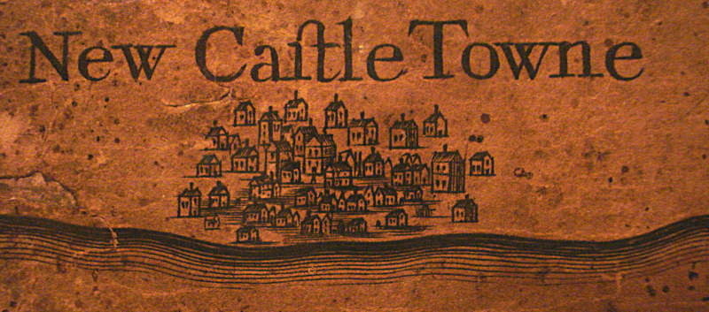
What did New Castle Towne look like in 1687?
Detail from the Penn real estate map
William Penn appointed Thomas Holme (1624-1691) to produce a survey of 'Pennsilvania' to promote the new province. The
"Map of The Improved Part of The Province of Pennsilvania in America" , finally produced in 1687, is now on display in
Cliveden a National Historic Trust site in Germantown,
6 miles from Philadelphia.
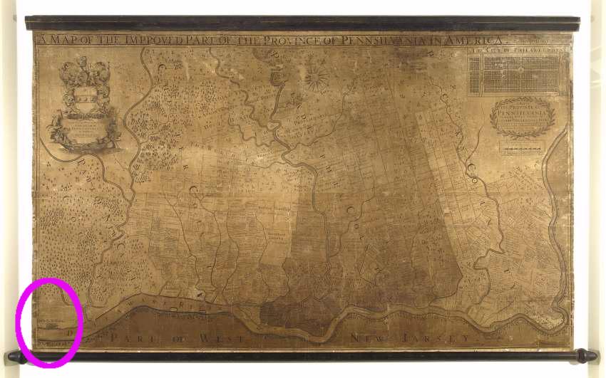
New Castle (in the lower left corner) is not mapped with the detail given to Philadelphia or the surrounding Penn properties but appears to be sketched in a somewhat symbolic non-realistic style. Holme was in Pennsylvania, and the map was drawn from actual surveys and survey records.
How accurate is the depiction? What did New Castle look like in 1687? The map shows perhaps 30-40 houses in 3-5 rows parallel to the river. No wharves are shown, nor are the streets. Perhaps 5 houses are two or more stories. In the center is a space, perhaps a commons or green with perhaps a post or statue.

Probably none of the buildings pictured survive today, though the Dutch house Museum of the New Castle Historical Society on 3rd street is probably of the period, as was the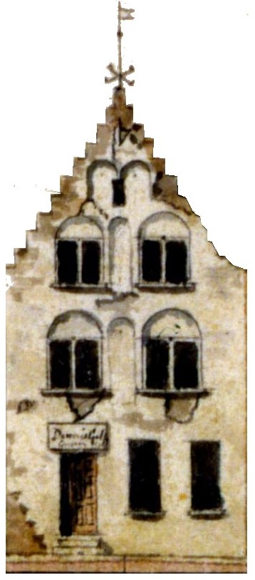 "
Tile house" (which had the date "1687" on its walls since the early 1800s).
"
Tile house" (which had the date "1687" on its walls since the early 1800s).
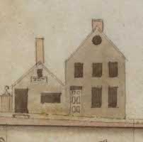 The Front Street
(The Strand) elevation by Latrobe in 1804 shows
28 and 30 The Strand
before they were
destroyed by the 1824 fire. The latter may be the structure built by
Bernard Ekon c1670
The Front Street
(The Strand) elevation by Latrobe in 1804 shows
28 and 30 The Strand
before they were
destroyed by the 1824 fire. The latter may be the structure built by
Bernard Ekon c1670
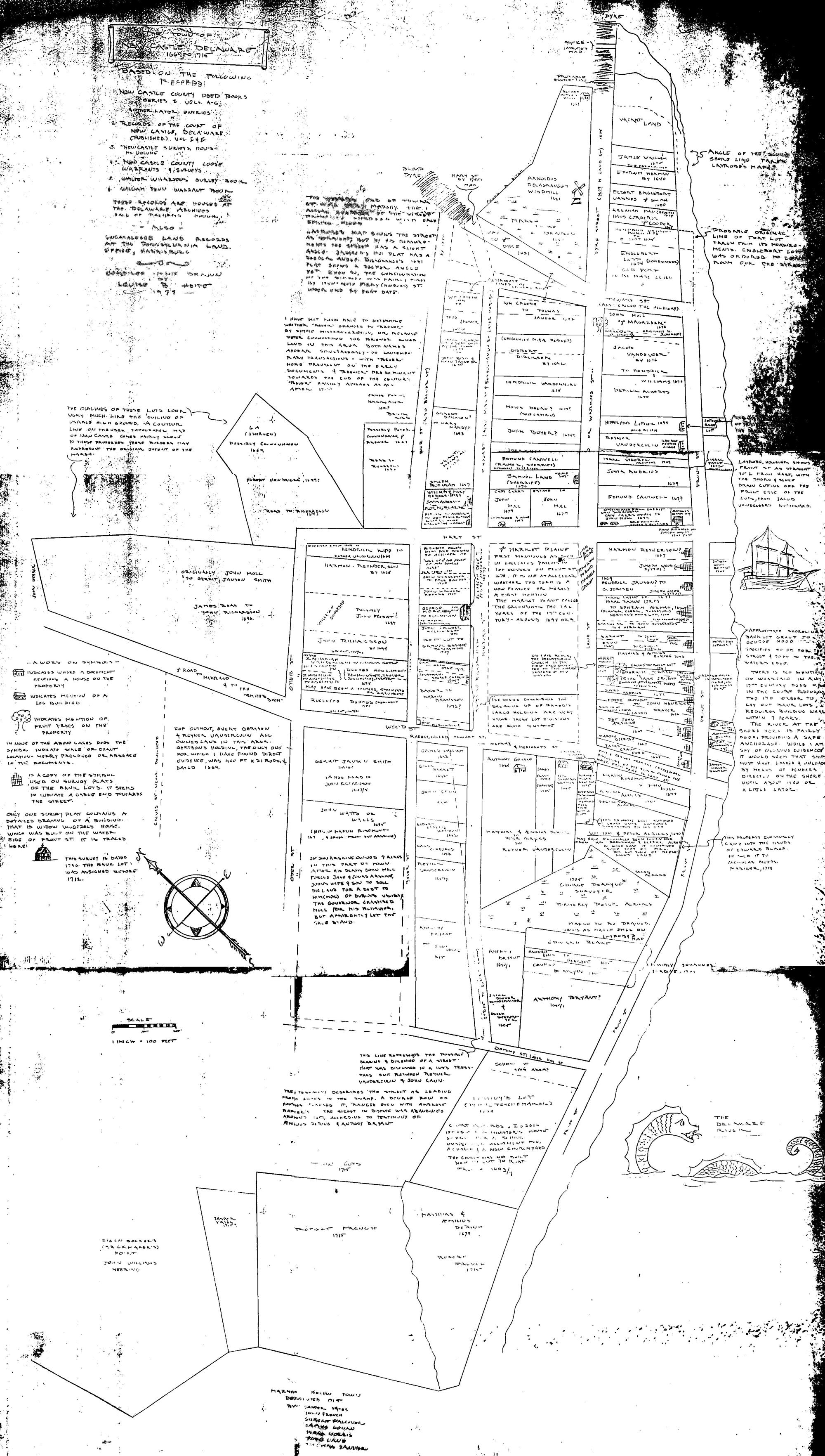
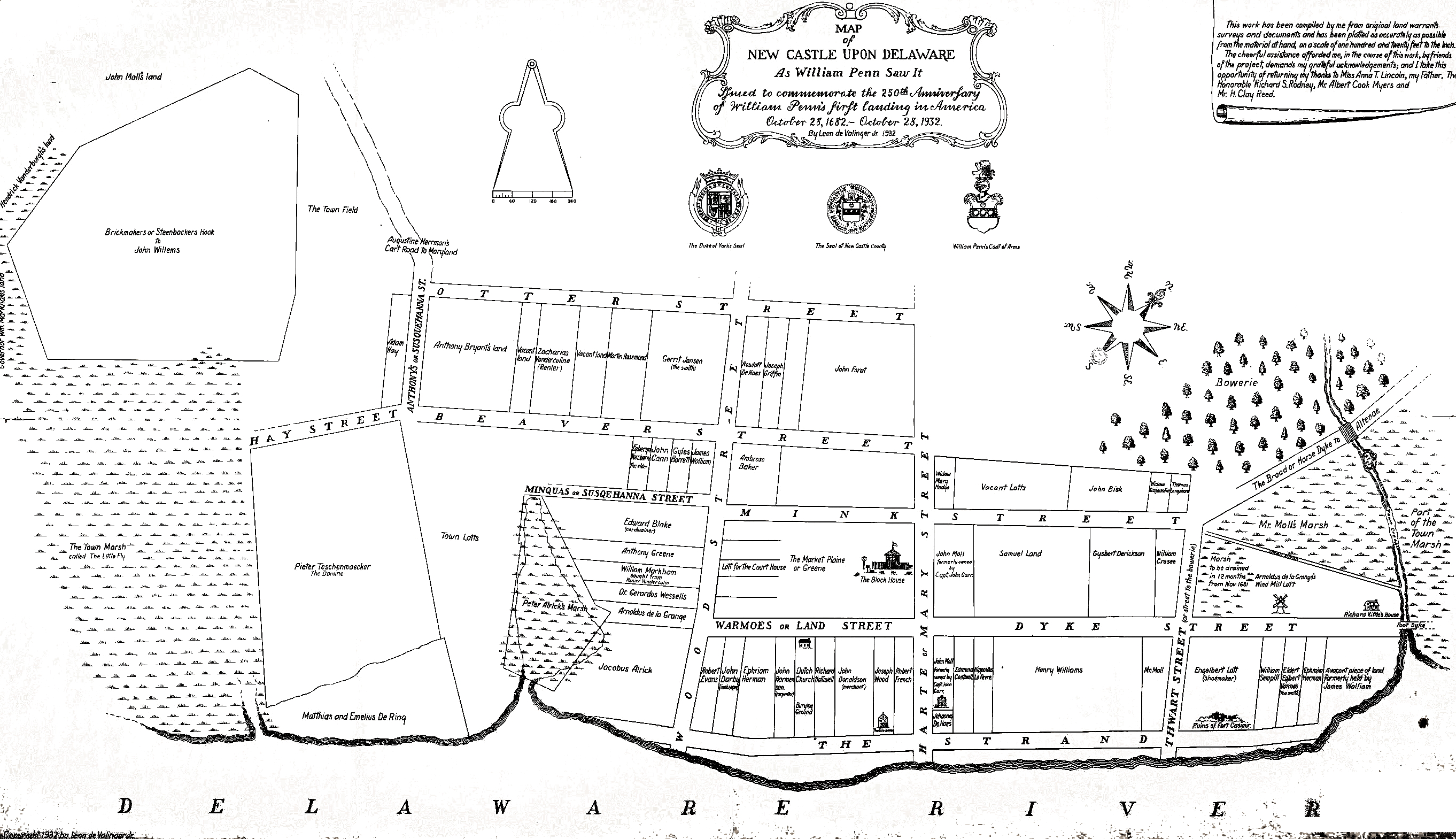
According to Eckman there were no houses on the river side of The Strand until after 1701. Harmony Street existed in 1687 as did Delaware Street and the Green.
In the northeastern corner of town on the site of Immanuel Church, we would expect to see the two story blockhouse that replaced the riverfront Fort Casimir. Roberts' 1987 archaeological report on the excavation under Immanuel summarizes the history. Fort Casimir was in disrepair by the arrival of the English in 1664 and replaced in 1677 by a blockhouse on the town square. This was a two story structure surrounded by a wall or palisade and entered through a gate. During the excavation under Immanuel after the fire of 1980, no definitive remains of the fort were discovered, although a cannonball was one of the artifacts found.
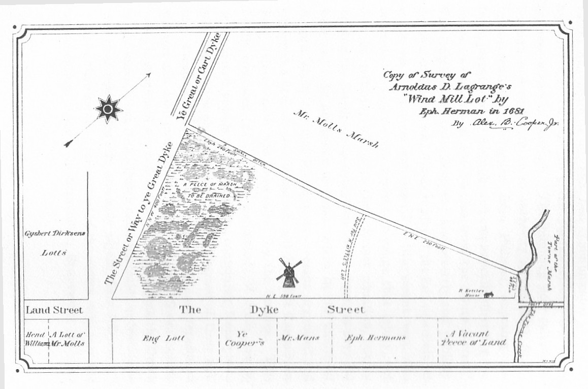
We might expect to see a windmill on 2nd street (dyke street) above the remains of Fort Casimir. According to the Cooper (1903) redrawing of the Lagrange deed of 1681, a windmill did exist at that time.
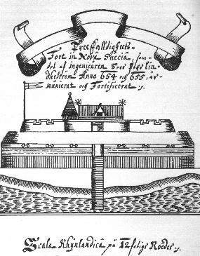 What else is there in the way of drawings of New Castle in the 1600's? Perhaps nothing but the sketch of its predecessor Ft. Casimir
by 'fortifications engineer' Pehr Lindestrom in 1653.
What else is there in the way of drawings of New Castle in the 1600's? Perhaps nothing but the sketch of its predecessor Ft. Casimir
by 'fortifications engineer' Pehr Lindestrom in 1653.
New Castle (in the lower left corner) is not mapped with the detail given to Philadelphia or the surrounding Penn properties but appears to be sketched in a somewhat symbolic non-realistic style. Holme was in Pennsylvania, and the map was drawn from actual surveys and survey records.
How accurate is the depiction? What did New Castle look like in 1687? The map shows perhaps 30-40 houses in 3-5 rows parallel to the river. No wharves are shown, nor are the streets. Perhaps 5 houses are two or more stories. In the center is a space, perhaps a commons or green with perhaps a post or statue.
Probably none of the buildings pictured survive today, though the Dutch house Museum of the New Castle Historical Society on 3rd street is probably of the period, as was the
"
Tile house" (which had the date "1687" on its walls since the early 1800s).
The Front Street
(The Strand) elevation by Latrobe in 1804 shows
28 and 30 The Strand
before they were
destroyed by the 1824 fire. The latter may be the structure built by
Bernard Ekon c1670
According to Eckman there were no houses on the river side of The Strand until after 1701. Harmony Street existed in 1687 as did Delaware Street and the Green.
In the northeastern corner of town on the site of Immanuel Church, we would expect to see the two story blockhouse that replaced the riverfront Fort Casimir. Roberts' 1987 archaeological report on the excavation under Immanuel summarizes the history. Fort Casimir was in disrepair by the arrival of the English in 1664 and replaced in 1677 by a blockhouse on the town square. This was a two story structure surrounded by a wall or palisade and entered through a gate. During the excavation under Immanuel after the fire of 1980, no definitive remains of the fort were discovered, although a cannonball was one of the artifacts found.
We might expect to see a windmill on 2nd street (dyke street) above the remains of Fort Casimir. According to the Cooper (1903) redrawing of the Lagrange deed of 1681, a windmill did exist at that time.
What else is there in the way of drawings of New Castle in the 1600's? Perhaps nothing but the sketch of its predecessor Ft. Casimir
by 'fortifications engineer' Pehr Lindestrom in 1653.