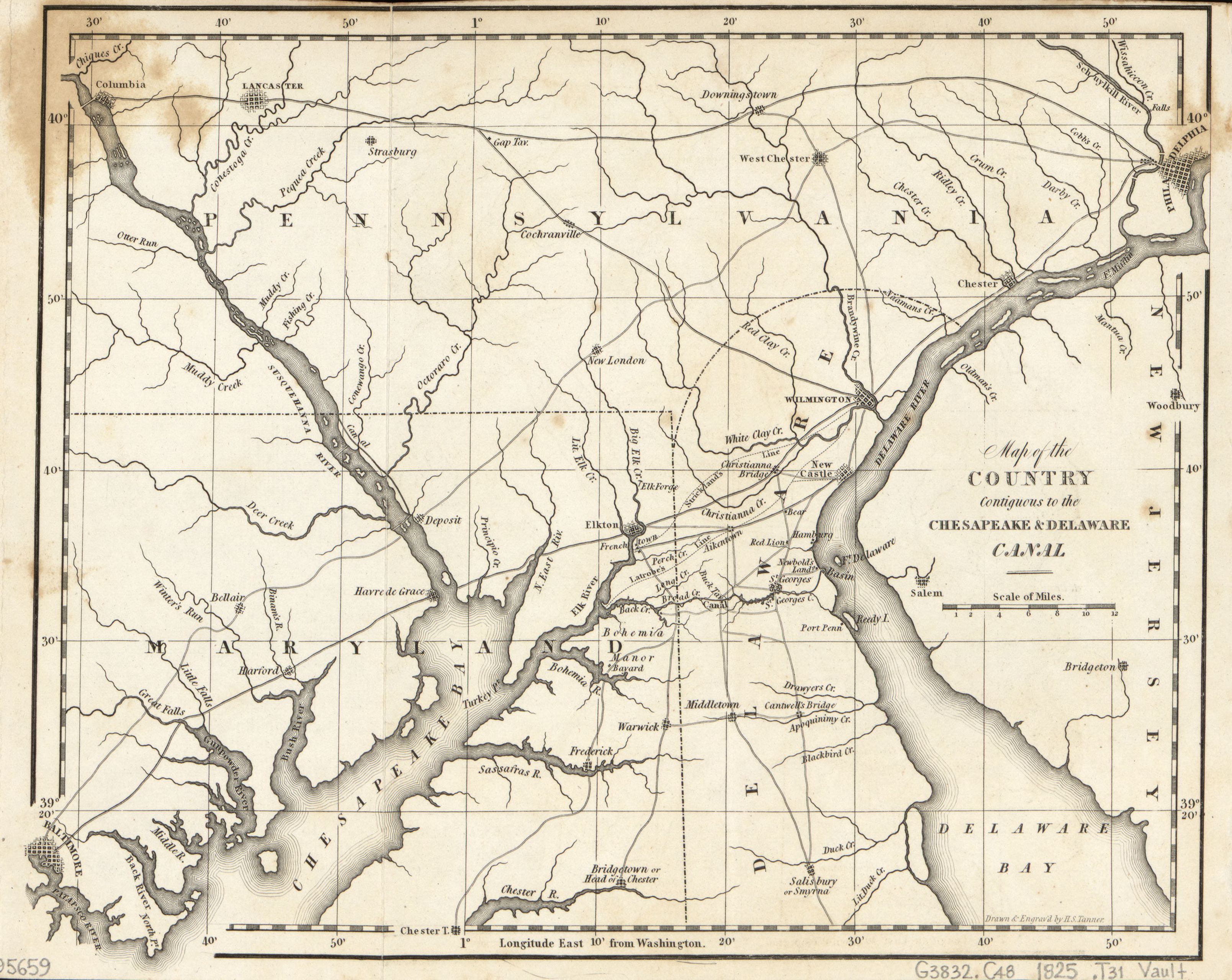
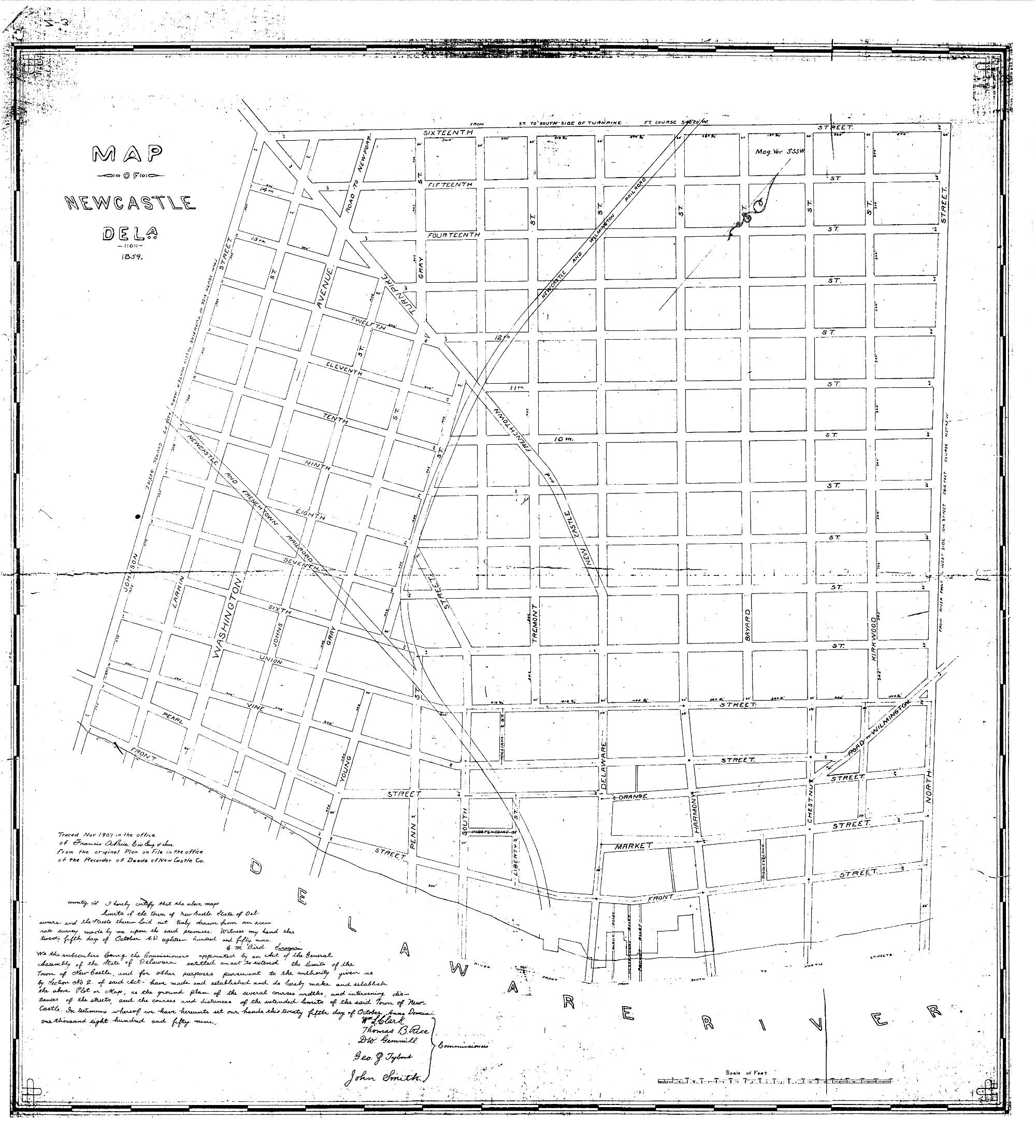
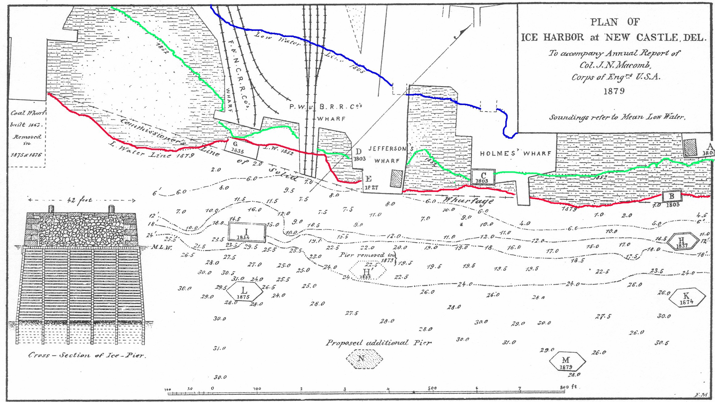
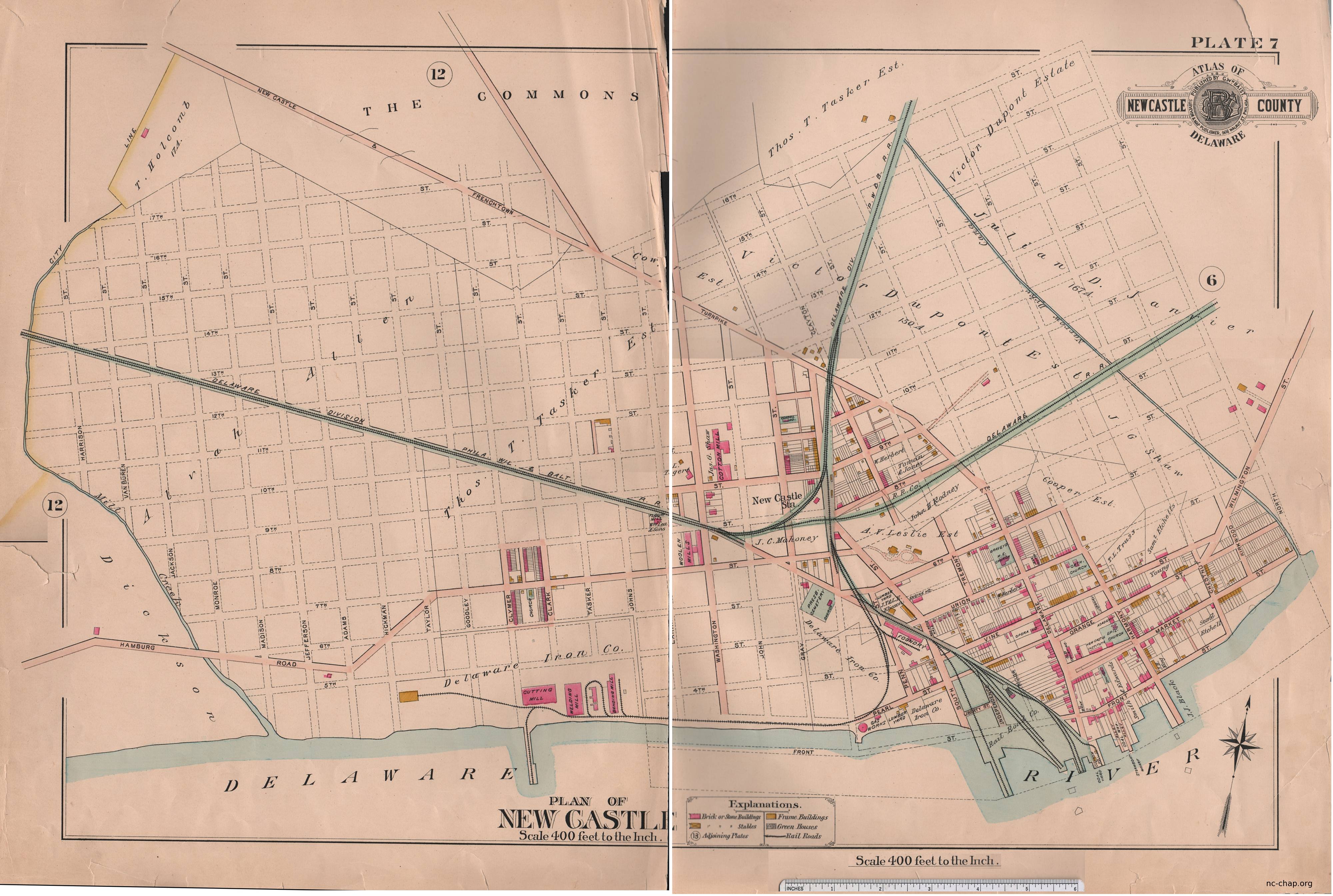
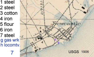
New Castle, Delaware
Community History and Archaeology Program
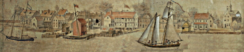
"A View of The Town of New Castle From The River Delaware, -- Taken the 4th July 1797 -- By Ives le Blanc" Courtesy G. Hargraves
New Castle, Delaware
Community History and Archaeology Program
"A View of The Town of New Castle From The River Delaware, -- Taken the 4th July 1797 -- By Ives le Blanc" Courtesy G. Hargraves
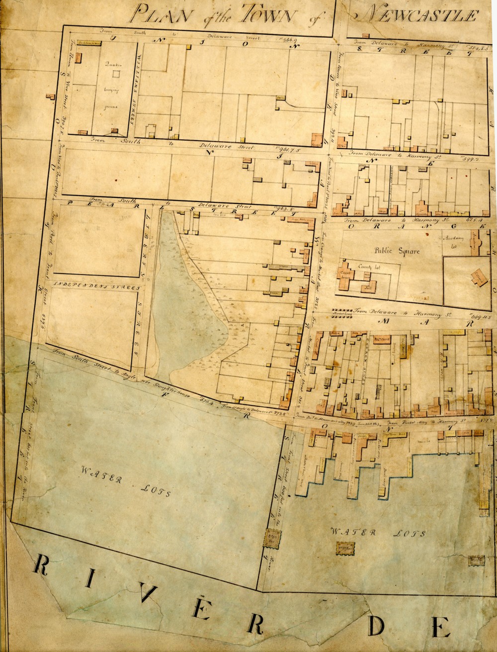
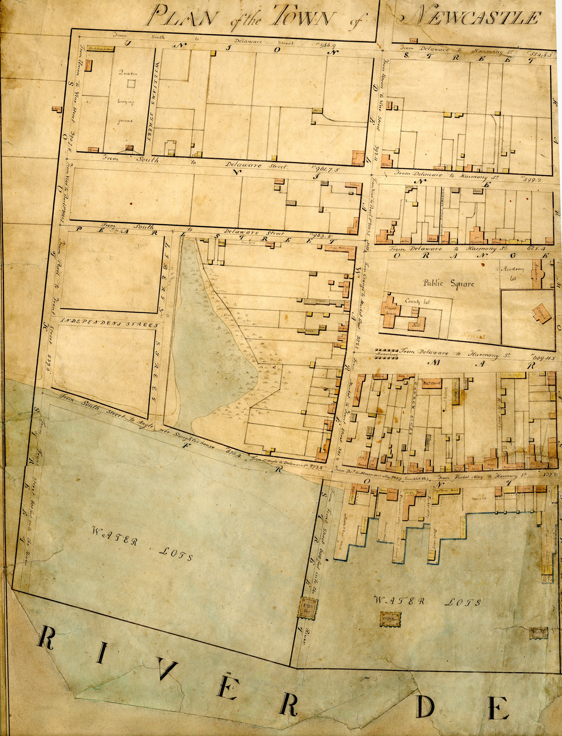
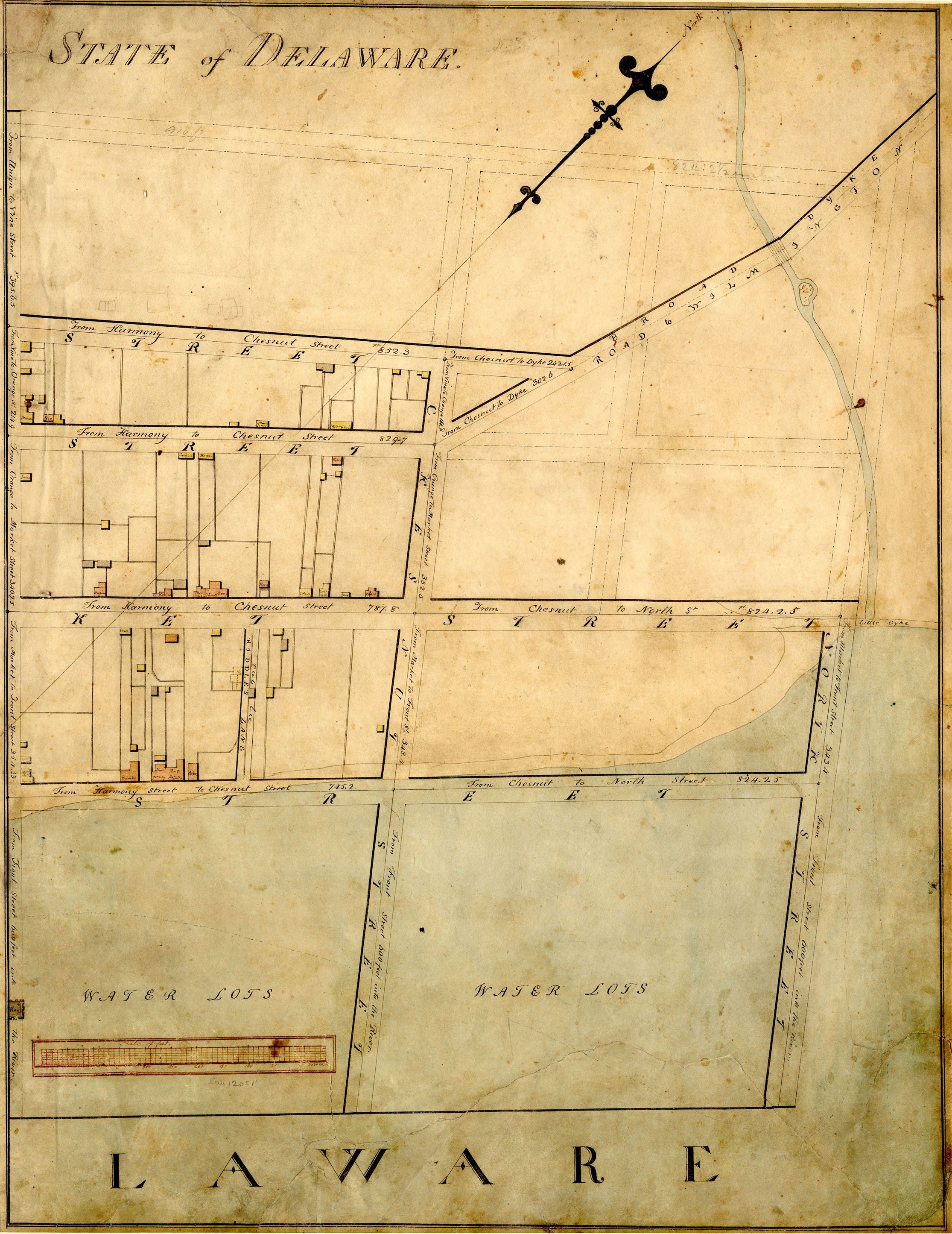
The Delaware Public Archives recently digitized the street plan in the Latrobe Survey. The two scans for each page were joined and reduced in definition to 75dpi using Photoshop and are available here at both medium (300 kb) and high resolution (~1.5 mb). Original 300-600 dpi jpg files (5-10 mb ea) are available via the web by emailing jlmeek (at) udel.edu.
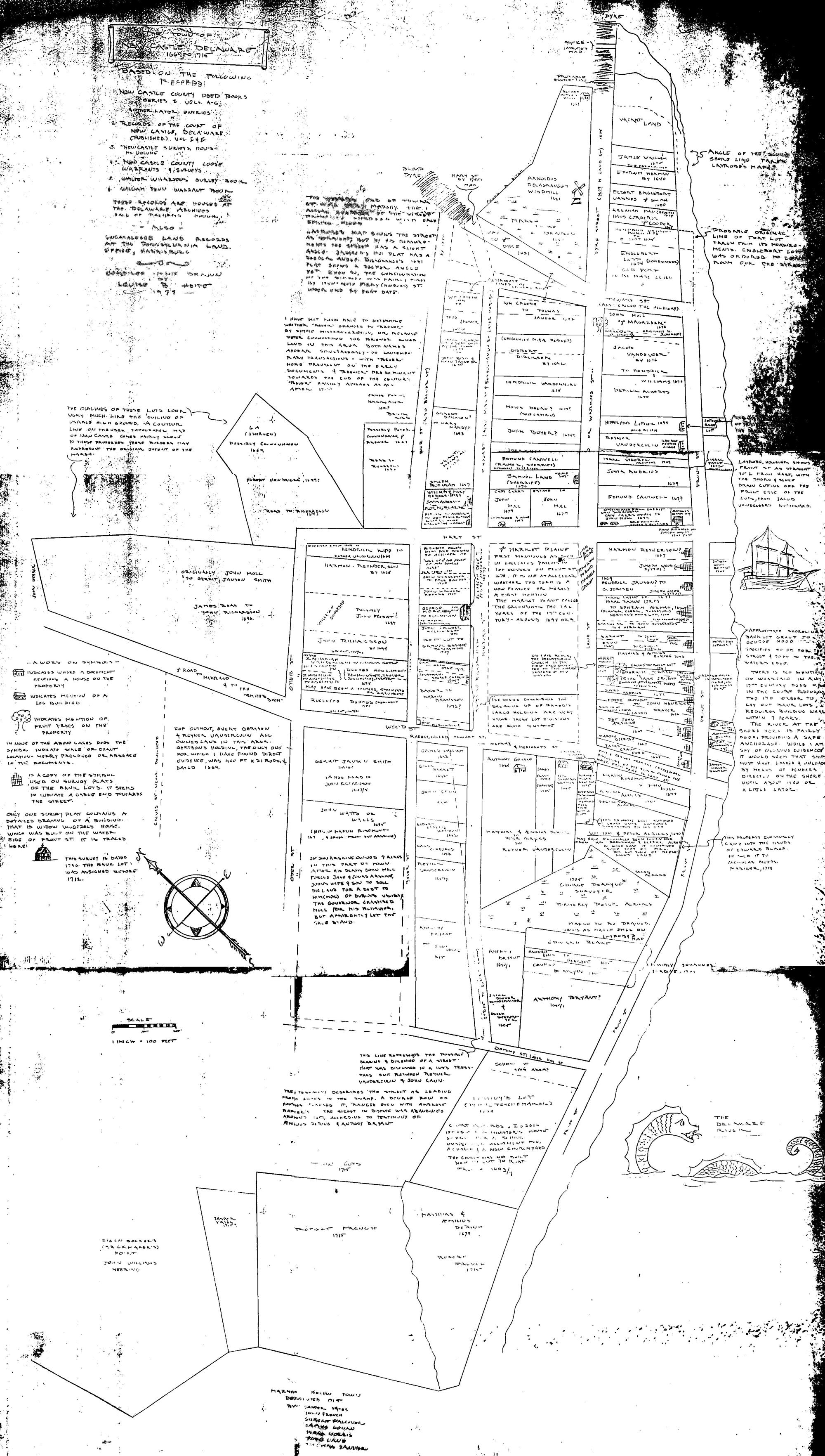
Note in the enlarged view the color code for buildings: yellow (wood) and tan (brick) houses and gray for stables. It is not clear whether some of the many wood structures (10-20 ft in width) in the backs of lots were residences or sheds.
The enlarged view allows reading of the owners or uses of many buildings -- The bark house for the tan-yard at 5th and South streets (present names), the Quaker school and burying yard at the side of the Goodwill Fire company, the slaughterhouse on Battery park, the post office next to the Read house, the Delaware hotel in the back of the Gunning-Bedford house, the Stage tavern next to Packet alley, the packet wharf (not on Packet Alley), the Ferry house (The Strand & Harmony Street wharf), the Jefferson tavern (3rd and Delaware, not in the 'Jefferson House'), Workhouse (The Green), Poorhouse (E 4th).....
| Page 1 | medium | high |
| Page 2 | medium | high |
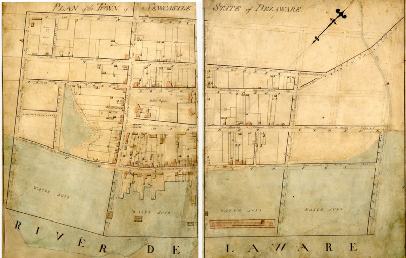
Source : Delaware Public Archives