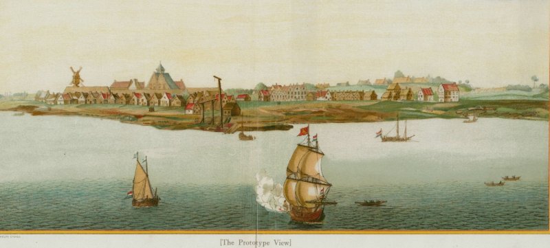
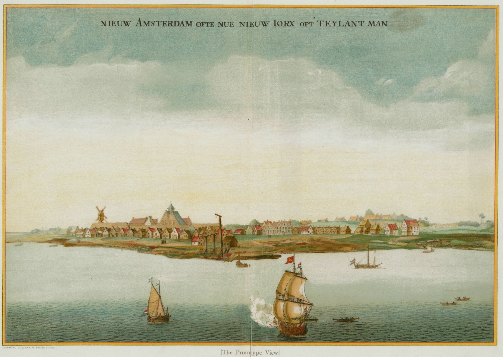
"Prototype View"
of New Amsterdam date depicted: c1651 From Phelps Stokes Iconography of Manhattan Island, 1915, Courtesy New York
Public Library. Click to enlarge
Houses and gardens in New Amsterdam during the late Dutch period are shown
in amazing detail in three images courtesy of the New York Public Library, the Maps Division of the Library of Congress
and Columbia University. They are the "Prototype View", an inset from the Visscher map and the the "Castello plan". The
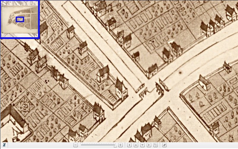
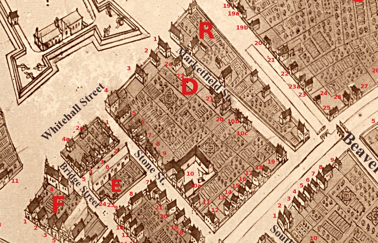
latter, created in 1660 by West India Company surveyor Jacques Cortelyou, shows sketches of the buildings and gardens of
every property in New Amsterdam
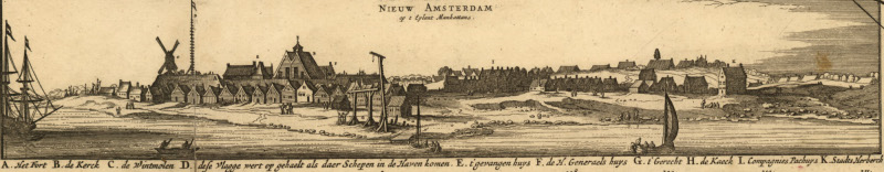
Inset from the
Visscher map "Novi Belgii", courtesy Map
Division, Library of Congress
The 1915 "Iconography of Manhattan Island" by Phelps Stokes is a superb and incredibly detailed 6 volume collection of
maps and historical information about Manhattan. Among its treasures in Vol. 2 are the "Castello plan" (so called
because the original was and is now stored in a Medici castello in Florence) and detailed historical descriptions of
every lot in New Amsterdam as it then existed. The full volume is available from
Columbia University Library, 400 mb, as well as
just the lot details
from here (12 mb).
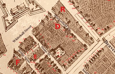
This page provides a
zoomable interface into a copy of the map, a
key for identification and location of interesting places, a
table listing
all lots and owners keyed to the map and Stokes'
Lot descriptions (pdf, 12mb)
| Zoomable version of the Castello map | Key to Castello map zoomable or jpg (1mb) | |
|  |
 "Prototype View"
of New Amsterdam date depicted: c1651 From Phelps Stokes Iconography of Manhattan Island, 1915, Courtesy New York
Public Library. Click to enlarge
"Prototype View"
of New Amsterdam date depicted: c1651 From Phelps Stokes Iconography of Manhattan Island, 1915, Courtesy New York
Public Library. Click to enlarge
 The "Prototype View" and the inset in the Visscher map depict the city
c1651-1653. Stokes suggest both may be copies of another drawing now lost. Some of the buildings shown in in the
Prototype view of New Amsterdam have crow-stepped gables and red tile roofs and are probably built of brick and stone.
In this detail, F5-F9 are warehouses, F10 the old church, O7 the house of captain Adriaen Blommaert and O8 the City
Tavern/Town Hall. Van Couwenhoven's house and brewhouse N2 appears to be of wood.
The "Prototype View" and the inset in the Visscher map depict the city
c1651-1653. Stokes suggest both may be copies of another drawing now lost. Some of the buildings shown in in the
Prototype view of New Amsterdam have crow-stepped gables and red tile roofs and are probably built of brick and stone.
In this detail, F5-F9 are warehouses, F10 the old church, O7 the house of captain Adriaen Blommaert and O8 the City
Tavern/Town Hall. Van Couwenhoven's house and brewhouse N2 appears to be of wood.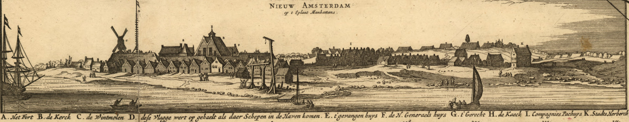 Most houses in New Amsterdam in 1657
were of wood with roofs thatched with the local reeds and probably had clapboard siding. From the Prototype View and
Castello plan most houses appear to have one story with a garret. Almost all buildings have their gable-end facing the
street. The siding shown in the Visscher inset looks to be to be generally horizontal clapboards, though vertical (board
and batten?) siding appears as well. The drawing may not be quite so accurate, since the church inside the fort has the
same pattern, but was built of stone.
Most houses in New Amsterdam in 1657
were of wood with roofs thatched with the local reeds and probably had clapboard siding. From the Prototype View and
Castello plan most houses appear to have one story with a garret. Almost all buildings have their gable-end facing the
street. The siding shown in the Visscher inset looks to be to be generally horizontal clapboards, though vertical (board
and batten?) siding appears as well. The drawing may not be quite so accurate, since the church inside the fort has the
same pattern, but was built of stone.  GIS analysis of the
Castello plan gives us an idea of the number and location of houses (253), taverns (20), public buildings (11), military
buildings (9) , as well as land use: formal gardens (59), orchards/trees (302) etc.
GIS analysis of the
Castello plan gives us an idea of the number and location of houses (253), taverns (20), public buildings (11), military
buildings (9) , as well as land use: formal gardens (59), orchards/trees (302) etc. 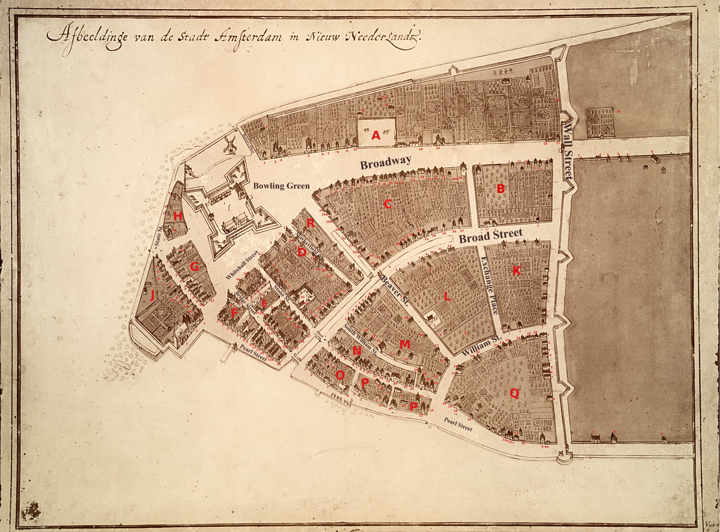